Showing posts with label Fiordland. Show all posts

Wednesday, August 19, 2015

New Zealand in 21 pictures

I've always had a thing for cameras. For years I shot with disposables just because I loved the funky pictures I got back. After endless envelopes of 4x6 prints, I stopped frequenting the 24-hour photo counters in drug stores because of the cost. And because I had enough pictures to plaster my walls five times over by my freshman year of college.

I did treat myself to a disposable camera before I left for New Zealand, knowing what a surprise it would be to develop the shots after getting back to the States months later. I knew there was no way I'd remember every single photo I took while there until I developed them, so it'd be a great reminder of hazier memories from my six months down under. 
Sunset from Mt. John Observatory, Lake Tekapo maybe?

Ironically, I had no idea where the first photo that developed was taken. This memory-jogging thing might not have been as flawless as I thought.


Summit of Mt. Somers, Canterbury, New Zealand

The last four photos were all taken on the hike from hell, aka Mt. Somers. The tramping club at my uni organized a number of tramps (hikes) during orientation week. Me, being the confident noob I was, signed up for the "advanced" tramp. DUMB. I was also a little dumb for using four of the 24 exposures on this one day. Definitely wasn't thinking of rationing out pictures like I would get used to as the semester pressed on. It was a learning experience. 

I'd go into more detail about that hike, but I have a whole post about it planned. You'll probably see it in three months from now. I hope that's just a joke. Anyway. 
Mueller Hut Track, Aoraki/Mt. Cook National Park, New Zealand

The picture of Claire, Charlie, and I (R to L) in front of Mt. Cook is probably one of my favorite shots in the whole bunch. You have no idea how stoked we were to have made it to Sealy Tarns (this viewpoint of New Zealand's tallest mountain). You also have no idea how sweaty we were.
 Sunset at Lake Tekapo, New Zealand

Words don't describe how insane this sunset was. We hitched back to Tekapo after our day on Mueller Hut Track -- unfortunately we didn't get to stay in the famous hut itself. Watching this sunset while sipping a beer made it well worth it though; despite my exhaustion from the day, I sprinted to the lakefront to snap a few shots of the tie-dye sky. 

Kaikoura, New Zealand (I think)

Mt. Fyffe, Kaikoura, New Zealand

I don't think I actually brought my DSLR with me on this overnight trip. That's one of the things I love about disposables: they're tiny and super lightweight. Basically a backpacker's dream.

Canterbury Museum, Christchurch, New Zealand

Routeburn Track, Fiordland National Park, New Zealand

Kepler Track, Fiordland National Park, New Zealand

I had totally forgotten about that picture of my legs in the snow on the Kepler Track. I wasn't exaggerating! 

Autumn at the University of Canterbury, Christchurch, New Zealand

Blowhole at Punakaiki "Pancake Rocks," West Coast, New Zealand

Wellington, New Zealand

Burwood Hospital, Christchurch, New Zealand

First selfie after this poor guy's operation. Pretty sure I spent more time in NZ's hospitals than I have in America's. Who knew I'd be learning so much about the country's healthcare system while studying abroad?

"That Wanaka Tree," Lake Wanaka, New Zealand

It seems appropriate that the last picture that came out, unfortunately some don't when you use a disposable, was of the tree I had been dying to see the whole time I was there. Going to Wanaka was a long time bucketlist item that I finally crossed off in between finals for various classes. 

I'm sad that a few shots didn't come out, including one of my dude and I in the airport less than twenty minutes before my flight took off to come back to America. Maybe that's okay though. I was crying. A lot. It wasn't pretty. 

So there it is, six months worth of adventures in 21 little pictures. 

Cheers!

Sunday, May 17, 2015

3 Weeks in 30 Litres: Routeburn Track (Part 3)


Kia ora everyone! 

Welcome to Part Three of the Great Hitchhiking Adventure. Took a wee break from the roads and hit the trails for a four day trek on the famous Routeburn Track.
The Routeburn is one of the Department of Conservation (DOC) Great Walks, so it ensures the trail will be well-maintained and promises great views.

The full track runs nearly from Te Anau to Queenstown and can be started from either direction. We started at the south western trailhead, walking in the direction of Queenstown. 
If you're planning to walk the Routeburn, plan ahead for how you'll get to the remote trailhead the day you begin. Check out the link above and select the "Getting There" tab for shuttle options. 
If you have access to a car (preferably which you aren't renting by the day), and know other trampers interested in the Routeburn, I'd recommend coordinating with them to park at opposite ends of the trail and hike the same days. You could even book a hut or campsite for the same night to meet up in the middle! No messy or expensive shuttles to rush to catch and tramping with friends -- what could be better? 
We did the 32km in four days but, as you can see from the elevation profile above, it can easily be done faster. Going at such a leisurely pace really gave us the chance to explore the awesome excursions and lakes along the way.

Day One:
          
"Jeez guys, New Zealand really is breathtaking."
"Yeah, literally and metaphorically."
View at Lake Howden Hut. Luckily the rain started just as we got to our stopping place for the day.
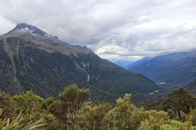
Claire, Charlie, and I decided to make the little trip up to Key Summit, one of the excursions from the huts. Many people told us that it was one of the highlights of the tramp, and others make Key Summit a full daytrip. Couldn't help but snap a few shots of the beautiful "view" we had of Lake Marian.

Day Two:
          
The forecast for the entire four day trip looked horrible; so bad there were serious hazard warnings for trampers. This track confirmed my belief that it's basically impossible to predict the weather in Fiordland. 
          
Yolo, I guess?
          
What was nice about short days like our second on the trail, which only took about four hours, was that it left plenty of time to explore/relax once we arrived at our stopping point. After we got to the campsite our second night, we got to explore the gorgeous Lake Mackenzie.
Climbing the vines that run along Split Rock, only a short walk from the campsite.

Day Three:
View of Lake Mackenzie from the trail above.
A little more than halfway on our longest day. Harris Saddle was a great lunch spot and a nice place to drop our packs and scramble up Conical Hill to the highest point on the track!
View of Harris Saddle Shelter from the track up Conical Hill.
The rest of the climb required a lot of focus (and often times both hands), so I didn't get too many shots showing the huge rocks we were climbing our way up.
          
One of my favorite parts of the whole track: SWING BRIDGES!
With worries about water and energy, Kim and Claire had continued walking the main track while Charlie and I made the lunchtime climb to the summit. It meant we arrived at our campsite around dark, but luckily the other two heeded the inclement weather reports and upgraded to the hut next to the campsite, meaning they were able to use the facilities to cook us dinner. 
Charlie's awesome tent, pitched at the Routeburn Flats campsite.

Day Four:
I didn't actually snap any pictures on the last day; sometime early in the morning, the bad weather they had been predicting for days finally rolled in. Charlie and I woke up on our last morning smack dab in the middle of one of the most impressive storms I've ever heard. Thank god we had decided to pitch her tent (the rainfly on mine is a little challenged). We stayed entirely dry as we listened to the storm rage around us. 
When it was time to pack up and head out, we dragged the whole tent, still pitched, under the treeline where there was a little more cover to put it away. 

During the final walk out, less than three hours total, it absolutely dumped rain on us. We may as well have gone for a swim with all our gear for how dry we stayed.

Personally, I loved it. (Being from Oregon, I felt very at-home hiking in the rain.) Besides, what better day than the last to get rained on? 

Once we arrived at the car park to wait for the shuttle that would be picking us up, we changed into whatever little had stayed dry in our packs and fired up our little cooker to heat up some hot cocoa and oatmeal. Not a bad way to wrap up an amazing four days.

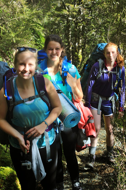
Time to meet the trampers! (aka a chance for me to brag about my awesome friends)
This is Kim, our resident "delicate flower." (Ironically, she's actually allergic to most flowers, as well as tree nuts, apples, and raw carrots.) Routeburn was actually Kim's first backpacking trip ever and she even planned the entire thing herself, from campsites to shuttles!
Charlie: Our scientist and outdoor-guru. Charlie is studying zoology (and, after spending a few months in NZ, is considering pursuing her new-found passion for moss). I think she's also half mountain goat. She's one of the quickest people I've ever seen on a mountain; if we hadn't booked a hut and two campsites, I bet Charlie would have done the whole Routeburn in a day.
This little ray of sunshine is basically our good luck charm. It's almost guaranteed that if Claire is around the weather will be stunning. Claire is studying creative writing and is one of the sweetest -- and most entertaining -- people I've ever met. 

Up next: adventures in Queenstown and the Kepler Curse. Thanks for reading, everyone!